|
How public safety GIS saves us when disaster strikes
By William Tewelow
National Alliance for Public Safety GIS (NAPSG) has contributed to recovery after every major disaster and many minor ones throughout the United States. Its success extends internationally — NAPSG has helped other countries set up their own public safety GIS support teams.
|
|
|

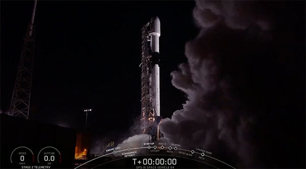
Fourth GPS III satellite successfully launched
The U.S. Space Force, Space and Missile Systems Center (SMC) and its mission partners successfully launched the fourth GPS III satellite at 6:24 p.m. EST Nov. 5 from Space Launch Complex 40 at Cape Canaveral Air Force Station, Florida.
|
|
|

L3Harris to help DOD with artificial intelligence, machine learning
L3Harris Technologies will help the U.S. Department of Defense (DOD) develop artificial intelligence and machine learning systems to help reduce the amount of time it takes to decipher usable intelligence from increasing amounts of data collected from space and airborne assets.
|
|
|

CGI to develop service to alert UK of GNSS disruption
The European Space Agency has awarded a contract to London-based CGI to develop a GNSS Event Notification Service capable of monitoring the United Kingdom GNSS spectrum to enable effective alerting and reporting of position, navigation and time disruption.
|
|
|
Resilient PNT critical to maritime advancement
The International Maritime Organization (IMO) has issued a resolution for maritime cyber-risk management effective in January 2021.
What it means to be a Gold Standard
Recently there have been conversations within the world’s position, navigation and timing communities regarding the use of the term “Gold Standard.” Many systems aspire to be a Gold Standard, but what does this mean and how should one rightfully claim this meritorious distinction?
|
|
|
GNSS Interference: Sources, Effects, Detection and Mitigation Techniques
Date: Dec. 3
Sponsored content by: Tallysman
Summary: Today's radio frequency spectrum is crowded with cellular, Wi-Fi, Iridium and Inmarsat signals. In North America, Ligado has recently received terrestrial broadcast rights to the 1526-1536 MHz spectrum. This could cause interference that affects antennas and GNSS receivers that support L-Band correction services. Tune in to this webinar for a discussion on interference on GNSS antennas and receivers: its sources and effects, detection methods, and mitigation techniques employed by precision GNSS antennas and receivers.
Speakers:
• Julien Hautcoeur, director of GNSS product R&D, Tallysman
• Wim De Wilde, systems engineer, Septentrio
• Peter A. Iannucci, postdoctoral research fellow, Radionavigation Laboratory at The University of Texas at Austin
|
|
|
|
|
