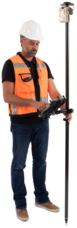
Popular Arrow Series GNSS receiver Features
• Universal Bluetooth to Apple, Android and Windows Devices
• Compatible with any off-the-shelf data collection app
• 30 to 60 cm with WAAS, EGNOS, MSAS, GAGAN
• 1 cm with RTK
• Worldwide 4 cm with AtlasTM Corrections
• Future-proof (GPS, Glonass, BeiDou, Galileo, QZSS)
• Pocket-sized, Rugged and Waterproof
Join Eos for free workshops during the pandemic
Take your KNOWLEDGE to the next level with workshops

During the ongoing pandemic, Eos will be hosting free high-accuracy data collection training workshops in GoToWebinar. These workshops are educational in nature, provide step-by-step live indoor and outdoor demonstrations, and are free to attend. Browse upcoming and past workshops:
1. Thursday, February 25: "High-accuracy data collection with Esri ArcGIS Field Maps and Eos Arrow Gold GNSS" Request the recording by emailing
2. Thursday, March 25: "Laser Mapping for ArcGIS Field Maps"
3. Thursday, April 29: "High-Accuracy Underground Utility Mapping in ArcGIS Field Maps"
Subscribe to be notified when registration opens
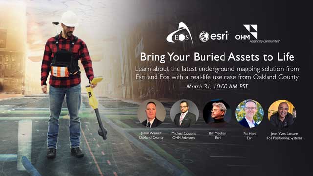
Join Eos for an underground utility mapping webinar
Take your UTILITIES to the next level with this webinar

Cut your field time in half, like they did in Oakland County, Michigan, when capturing mixed utilities in high-accuracy. In this webinar, you will learn how to bring your buried assets to life and have the opportunity to ask experts from Eos, Esri, and OHM Advisors any questions about mobile underground utility mapping.
"Bring Your Buried Assets to Life: Map underground utilities in ArcGIS Field Maps” Wednesday, March 31, 2021
|
| ARROW GOLD • Triple frequency, multi constellation |  |
ARROW 200 • Dual frequency, multi-constellation | ||
ARROW 100 • Single frequency, multi-constellation | ||
ARROW LITE • Single frequency, single constellation |
Browse Arrow Success Stories | |
| IN NORTHERN CANADA, WINTER TIMBER OPERATIONS GO DIGITAL (FORESTRY) In the dense woods of Northern Canada, obtaining accurate locations under canopy proved challenging. By upgrading to Eos Arrow 100 GNSS receivers, Tolko Industries easily obtained high-accuracy data in remote areas. Read about their innovative harvesting solution... PRESERVING AUSTRALIA’S HERITAGE SITES WITH HIGH-ACCURACY (PRESERVATION)Australian Cultural Heritage Management takes on hundreds of heritage management projects each year throughout Australia that require high-accuracy GIS data. Watch how they made history – while preserving it… FIELD DATA COLLECTION IMPROVES ACCESS TO MOUNTAIN BIKING TRAILS IN QUÉBEC (RECREATION) Just over a year ago, Velo Quebec set out to map an extensive network of cycling trails across the province, not only with high accuracy, but also at high speed! Learn about their high-speed mapping adventure... |
| Have a Question ? | |

| You are currently subscribed as newsletter@newslettercollector.com. If you wish to leave this mailing list, simply unsubscribe. | Refer to our Privacy Policy. GPS World is a property of North Coast Media, LLC. 1360 E. Ninth St., 10th Floor, Cleveland, OH 44114 © 2021 North Coast Media. All Rights Reserved. Reproduction in whole or in part is prohibited without written permission. |
