| | | 
| | | | By Tim Burch
Mason and Dixon were pioneers in bringing geodetic astronomy to the American colonies. Through the efforts of the Mason and Dixon Line Preservation Partnership, we can promote this scientific contribution along with the placement of the boundary stones. | | |
| |
|
| | | | | 
| | | | By Simon Harris
Lidar-based surveying is increasing in demand across a range of industries. | | | | |
| |
|
| | | | | 
| | | | The United States Space Force (USSF) is committed to maintaining a healthy GPS constellation that continues to deliver the “gold standard” of PNT availability and reliability throughout the world. | | |
| |
| | | | | 
| | | | Juniper Systems has introduced the Geode GNS3 GNSS receiver, which allows users to collect real-time GNSS data with sub-meter, sub-foot and decimeter accuracy options. | | |
| |
| | | | | 
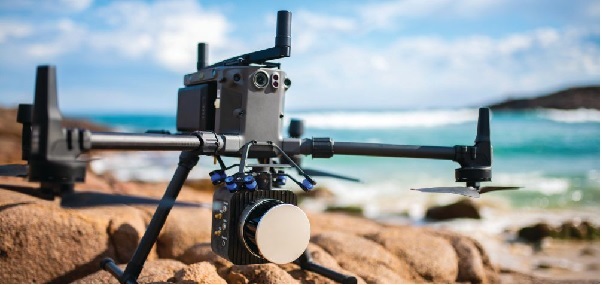
| | | | ComNav Technology has released a powerful and reliable UAV aerial mapping solution capable of centimeter-level positioning, providing high-precision photos and data for mapping professionals. | | | | |
| 
| | | | GeoCue has announced its latest True View 3D Imaging Systems (3DIS) product, the True View 645/650. | | | | | | | | | | |
| |
|
| | | | | | | Recently, various research and publications across the globe are pointing out the rising trend of Software Defined Architecture for GNSS. Software Defined Radios (SDRs) are allowing a quick and simple implementation of wireless receiving and transmitting systems by combining the power of Digital Signal Processing (DSP) with the flexibility of programmable hardware. During this webinar, each speaker will examine some of the work being done by the organizations leading the way on this migration to a software defined architecture. | | Registering gives you access to this webinar even after it airs! | | |
| | &uuid=(email)) | | | | Date: May 12
Time:1 p.m. Eastern
Duration: 60 minutes + time for Q&A
Sponsored by: Orolia
Lisa Perdue, Product Line Director GNSS Simulation at Orolia
M. Zahidul H. Bhuiyan, Research Professor at the Department of Navigation and Positioning at Finnish Geospatial Research Institute (FGI)
John Fischer, VP Advanced R&D, Orolia | | |
| |
|
|

&uuid=(email))
&uuid=(email))

&uuid=(email))
&uuid=(email))


&uuid=(email))

&uuid=(email))


&uuid=(email))