View Here!


AUGUST 5, 2020
 
  INSIGHTS
 
Image: National Geodetic Survey
 
 
NGS releases modernized National Spatial Reference System updates
 
By David Zilkoski
The National Geodetic Survey (NGS) has announced two new items related to the modernized National Spatial Reference System (NSRS).

 
Read More


  MORE NEWS
 
Photo: AP Surveying PLLC  
Case studies reveal survey tech advances
 
Surveyors share their success stories using the latest GNSS receivers, software and correction services, all of which are constantly improving to make their tasks easier — despite the terrain or weather conditions.
 
Read More
 
View Here!
 
  Image: Spectra Geospatial  
Spectra Geospatial, Aplitop partner on tunneling survey solution
 
Spectra Geospatial is partnering with Aplitop for a comprehensive tunnel survey solution designed to increase productivity for survey service providers.
 
Read More
 
  Photo: Tersus GNSS  
Tersus GNSS offers new generation of tilt survey receiver
 
Empowered by a high-precision inertial measurement unit on the Ultimate version, the Oscar from Tersus GNSS is a new generation of tilt survey receiver.
 
Read More
 
  Image: EOS Positioning
 
Eos Positioning Systems releases Eos Tools Pro for Windows
 
Eos Positioning Systems — manufacturer of Arrow Series GNSS receivers — has released Eos Tools Pro for Windows 10.
 
Read More
 
View Here!
 
  Photo: Trimble  
New players offering GNSS correction services
 
Today, dozens of public and commercial correction services enable users to achieve accuracies of decimeters, centimeters or even millimeters.
 
Read More
 
  Photo: Trimble
 
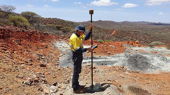
Smart surveying in the Outback
 
Advances in precise point positioning technology have been helping resolve surveying obstacles in the Australian Outback and enabled surveyors to optimize their real-time productivity without sacrificing accuracy.
 
Read More
 
  Photo: Matt Sibole  
Remembering all fixes for verification
 
Matt Sibole is a solo surveyor and a Javad GNSS advocate. Based in Kentucky, Sibole tackles up to 140 jobs a year, which he would be unable to do using only a total station or a robotic station. Instead, he relies on the accuracy of GNSS.
 
Read More
 
  Photo: Stephen Drake  
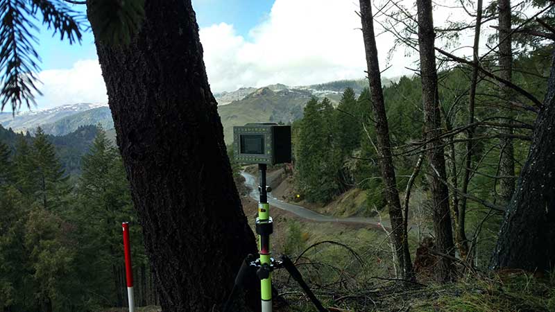
Surveying switchbacks in the Northern California mountains
 
In the mountains of Northern California, a dangerously twisting stretch of road — the site of numerous fatal accidents — is being widened and realigned. Because it passes through the Six Rivers National Forest, the Highway 36 project is managed by the Federal Highway Administration (FHWA) in partnership with Caltrans.
 
Read More
 
  Image: Bad Elf  
Bad Elf GNSS receiver adopts Hemisphere Phantom module
 
Bad Elf LLC has completed transition of all Bad Elf Flex receivers to the Hemisphere GNSS Phantom OEM module.
 
Read More
 
  Photo: Trimble  
Everest survey succeeds with Trimble GNSS
 
The Survey Department of the Government of Nepal has completed fieldwork for the National Initiative for the Measurement of the Height of Sagarmatha (Mount Everest).
 
Read More
 
  Logo: Brandt  
Brandt acquires Sokkia Canada from Topcon
 
The Brandt Group of Companies successfully acquired the assets of Ontario-based Sokkia Canada in a deal with owner Topcon Positioning Systems.
 
Read More
 
 
  VIDEO SPOTLIGHT
 
Video still: GPS World Staff
 
Hemisphere GNSS presents Phantom, Vega GNSS OEM boards
 
Hemisphere GNSS’ Miles Ware gives GPS World an overview of the company’s Phantom and Vega series GNSS OEM boards at Intergeo 2019, which took place in Stuttgart, Germany.
 
Watch Now
 
  FROM GPS WORLD MAGAZINE


Number of trained US geodesists at crisis level
 
By David Zilkoski
Geodetic science and technology now underpin many sciences, large areas of engineering (such as driverless vehicles and drones), navigation, precision agriculture, smart cities and location-based services. Geodesy is actually more important than ever. 

 
Read More


Editorial Advisory Board PNT Q&A: Opportunities with GNSS correction services
 
New players are offering GNSS correction services — pushing prices down and offering new business models. What opportunities does this open up? 
 
Read More
 
Cover photo: Draganfly
 
 
  UPCOMING WEBINAR
 
The Virtual Primary Reference Time Clock: A Next-Generation Timing Architecture for Critical Infrastructures
 
Date: Aug. 27
Sponsored Content by: Microchip
 
 
Summary: Accuracy, precision and stability have traditionally been used to describe the requirements for timing and synchronization. Although these timing metrics remain vital, a new set of requirements have become equally important with the goal of delivering better resiliency in critical infrastructure: prevention, restoration and recovery. A variety of technologies are being discussed to create a back-up to GNSS. The answer to greater resiliency does not lie in the number of timing sources, but rather in a timing architecture that incorporates these technologies. This presentation will discuss how a Virtual Primary Reference Timing Clock architecture is optimized for resilient timing.
 
Speakers:
• Tony Flavin, manager, strategic research, Chronos Technology Ltd.
• Jim Olsen, senior solution architect, Microchip
• Lee Cosart, chair of ATIS SYNC Committee, Microchip

 
Register Here
 
View Here!
 
Logo: GPS World Logo: Twitter  Logo: Facebook  Logo: YouTube  Logo: LinkedIn

You are subscribed to Survey Scene as newsletter@newslettercollector.com.

Forward to a friend | Change your subscription preferences | New subscriber sign-up
To leave this mailing list, simply unsubscribe. | Refer to our Privacy Policy.

GPS World is a property of North Coast Media, LLC.
1360 E. Ninth St., 10th Floor, Cleveland, OH 44114
© 2020 North Coast Media. All Rights Reserved.
Reproduction in whole or in part is prohibited without written permission.