View Here!


APRIL 7, 2021
 
  INSIGHTS
 
Image: NGS
 
 
NGS revises NOAA report on working in the modernized NSRS
 
By David Zilkoski
The National Geodetic Survey (NGS) has revised an important technical document on the modernized National Spatial Reference System (NSRS). Zilkoski explores a use case on flood mapping, discussing an Elevation Certificate example, Flood Insurance Rate Map and Flood Insurance Study.

 
Read More
 
  NEWS
 
Photo: CHC Navigation  
UAVs take flight: Commercial and industrial applications
 
Commercial applications continue to grow, with unmanned aerial vehicles (UAVs) — known as drones in the vernacular — gathering data and observations for agriculture, mining, utility inspections, natural resources, historical preservation, security, and many more applications.
 
Read More
 
View Here!
 
Photo: Wingtra  
Diving into UAV lidar surveys
 
The worlds of unmanned aerial vehicles (UAVs), lidar and surveying overlap, with UAV-based lidar able to shed light on places that are difficult or dangerous to access by other means.
 
Read More
 
Photo: CHCNAV
 
CHC Navigation launches light, accurate UAV lidar system
 
CHC Navigation (CHCNAV) has released the AlphaAir 450 (AA450) lidar system, a lightweight, compact all-in-one sensor for unmanned aerial vehicles (UAVs).
 
Read More
 
Photo: Trimble  
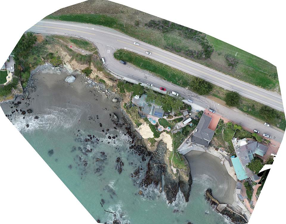
A new angle on mapping cliffs on California’s shore
 
Cliff surveys are traditionally performed with fixed-wing aircraft that collect nadir photos. However, a photogrammetry company accurately triangulated oblique images and mapped them in 3D stereo, developing a new technique in the process.
 
Read More
 
Photo: CHC Navigation  
UAV and lidar combination maps mine, tunnel mouth
 
The Xinjiang Institute of Ecology and Geography conducted a nine-day project on the Heishan Mining Zone in Toksun County, Xinjiang Province, China.
 
Read More
 
Photo: stock_colors/iStock/Getty Images Plus/Getty Images
 
Rokubun launches JASON GNSS PPK service in the cloud
 
Rokubun has launched JASON, a satellite navigation service for accurate geolocation. With JASON, users can achieve highly accurate geolocation without a base station, Rokubun said.
 
Read More
 
Photo: Bad Elf


Bad Elf, ProStar partner on utility data solution
 
Mapping company ProStar Holdings Inc. and survey device company Bad Elf have partnered to produce a solution designed to gather the precise location of surface and subsurface utility data.
 
Read More
 
Screenshot:
 
Trimble introduces Siteworks SE Starter Edition for construction
 
Trimble has introduced the Trimble Siteworks SE Starter Edition, an entry-level construction surveying software program.
 
Read More
 
  FROM THE MAGAZINE


Taking stock in West Virginia: UAVs save WVDOT time and money
 
The West Virginia Department of Transportation (WVDOT) turned to unmanned aerial vehicles (UAVs) to save time and money. Incorporating drones has saved WVDOT more than $340,000 in a single month.
 
Read More


Taoglas GNSS antenna flies with parrots
 
Drone-maker Parrot chooses Taoglas a passive patch antenna ANAFI USA drone for its lightweight design and ability to withstand high winds.
 
Read More
 
Cover photo: CHC Navigation
 
Logo: GPS World Logo: Twitter  Logo: Facebook  Logo: YouTube  Logo: LinkedIn

You are subscribed to Survey Scene as newsletter@newslettercollector.com.

Forward to a friend | Change your subscription preferences | New subscriber sign-up
To leave this mailing list, simply unsubscribe. | Refer to our Privacy Policy.

GPS World is a property of North Coast Media, LLC.
1360 E. Ninth St., 10th Floor, Cleveland, OH 44114
© 2021 North Coast Media. All Rights Reserved.
Reproduction in whole or in part is prohibited without written permission.