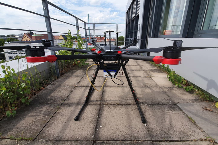
| Search-and-rescue drone debuts, FAA issues remote ID rule
By Tony Murfin
GPS World columnist Tony Murfin looks at developments regarding a potential drone solution for finding disaster victims, the Federal Aviation Administration (FAA) issuing its remote ID rule and the Boeing Loyal Wingman's maiden flight in Australia.
|
|
|

IFEN enhances its NCS Nova GNSS simulator for Galileo OS
IFEN GmbH, a manufacturer of GNSS navigation test products and services, announced that its NCS Nova GNSS simulator now fully supports the simulation of Galileo Open Service (OS) signal improvements based on the new Galileo OS SIS ICD V2.0.
|
|

Jackson Labs offers miniature STL LEO receiver
Jackson Labs Technologies Inc. (JLT), a designer and manufacturer of GNSS, timing and frequency equipment, has announced the availability of the STL-2600 Satellite Timing and Location (STL) receiver designed in partnership with Satelles Inc., the STL service provider.
|
|
|
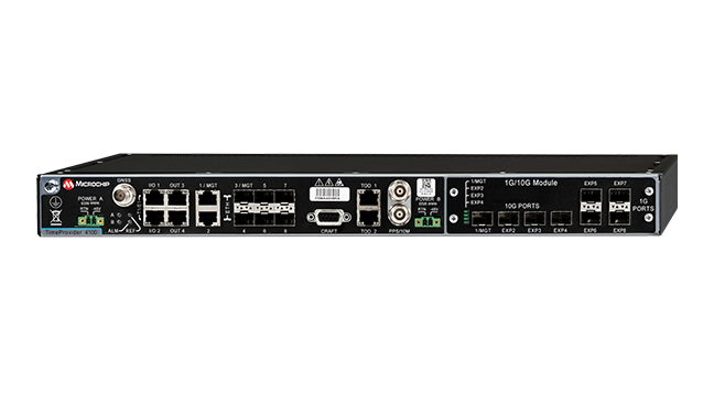
Microchip TimeProvider 4100 Grandmaster now more resilient
Microchip Technology Inc.’s TimeProvider 4100 Release 2.2 grandmaster introduces innovative redundancy architecture in addition to support for a multi-band GNSS receiver and enhanced security to ensure always-on precise timing and synchronization.
|
|
|
2021 Simulator Buyers Guide
In our 10th annual Simulator Buyers Guide, we feature simulator tools, devices and software from 10 prominent companies that aid GNSS receiver manufacturers in product design.
How GNSS guidance improves precision agriculture and construction
Using data from GNSS satellites, total stations and 3D models, machine-control hardware and software solutions determine a machine’s current position on the Earth and compare it with the desired design surface, mining task or cultivation technique.
|
|
|
Collecting Remote Asset Locations Using GNSS, GIS Apps and Laser Offset Mapping
Date: March 25
Sponsored Content by: Laser Technology Inc.
Summary: Map more, move less. By combining laser rangefinders with your GNSS receiver, smart device and preferred GIS mapping app, you can collect remote assets safely and efficiently. Learn about the different mapping workflows and the offset position accuracies you can achieve with equipment you already own.
Speakers:
• Derrick Reish, Senior Product Manager, Laser Technology Inc.
• Mike George, GISP, sUAS, GIS Director, Project Manager, DDSI Global
|
|
|
|
|

&uuid=(email))
&uuid=(email))

&uuid=(email))

&uuid=(email))
&uuid=(email))

&uuid=(email))